I recently blogged about my new productivity device (AKA my new toy), an AT&T Tilt. I’ve been using a Motorola Q for years and missed the capabilities of a PDA phone (like the Tilt) versus a a smart phone (like the Q). The Q had superior voice quality and a better overall phone experience but the Tilt has a vast number of features and functionality that make it much more than a cell phone.
Introducing TrackMe, GPS tracking software
One of these great features the Tilt has is built-in GPS receiver. When you bundle a GPS with a Windows powered device and add on top of that a 3G data network, the creative applications start to flow and one such application is called TrackMe. TrackMe records your GPS data every few seconds and stores it in a local SQL2005 compact edition database (I should note it’s written on the .NET 3.5 Framework). It then creates data files that are compatible with Google earth. You can take it a step further and embed GeoCodes (gps coordinates) into your photos taken with your camera and provide not only the path you took but show pictures along the way. But wait, it gets cooler.
You can also get a special tracking script that uses PHP and MySQL and load it on your website and let TrackMe feed your information back to your server in real-time.
Seeing the results of TrackMe
This weekend I was fortunate enough to be invited to the Telefonica Second Annual Fishing Tournament which was held as part of their Leadership Conference. The fishing tournament was made up of about 30 people spread across 5 charter boats all fishing for game fish. I decided that I didn’t that this would be the perfect oppurtunity to use TrackMe (in case our 3 hour cruise turned into a much longer trip ala Gilligan’s Island).
What was interesting on this trip was that immediately as the boat took off everyone fired up their GPS on the smartphone of choice and started tracking the co-ordinates of where the captain was taking us to! (it didn’t do much good though the only fish caught on this trip was the 1 little 8lb king-fish I got).
Anyway, you can see my TrackMe results here. You’ll want to select “none” under trip and click show and it will show all my data points out of Key Biscayne. You can also see Map view and satellite view (which is the more interesting of the two)
Here’s a few cool screen shots:
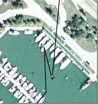
Our boat was actually in the third slip at the marina there.
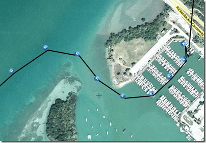
Here’s the path we took coming out of marina
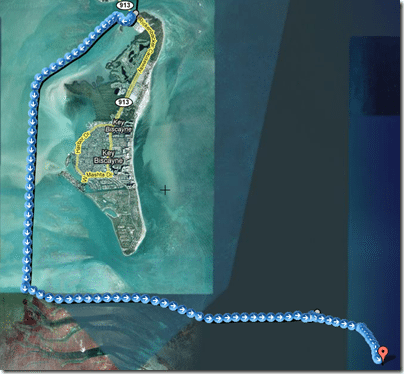
Here’s a bird’s eye view of the entire path we took. (I stopped taking measurements when the first fish started biting)
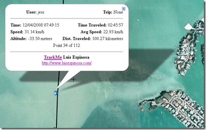
Finally, if you click on any of the point it will give information regarding speed, etc.
Unfortunately, I didn’t take any photos on this trip but there’s always the next blog post for that 🙂
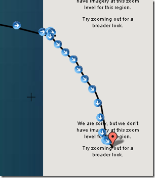
Oh one last post, Christopher Columbus might have been the first to discover the world wasn’t flat but now I too have taken a boat ride off the edge of the world (albeit the google earth world) 🙂 :
